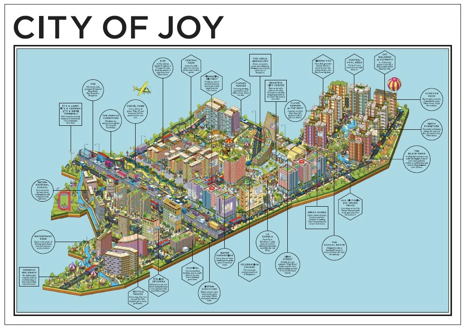
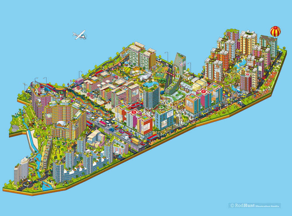
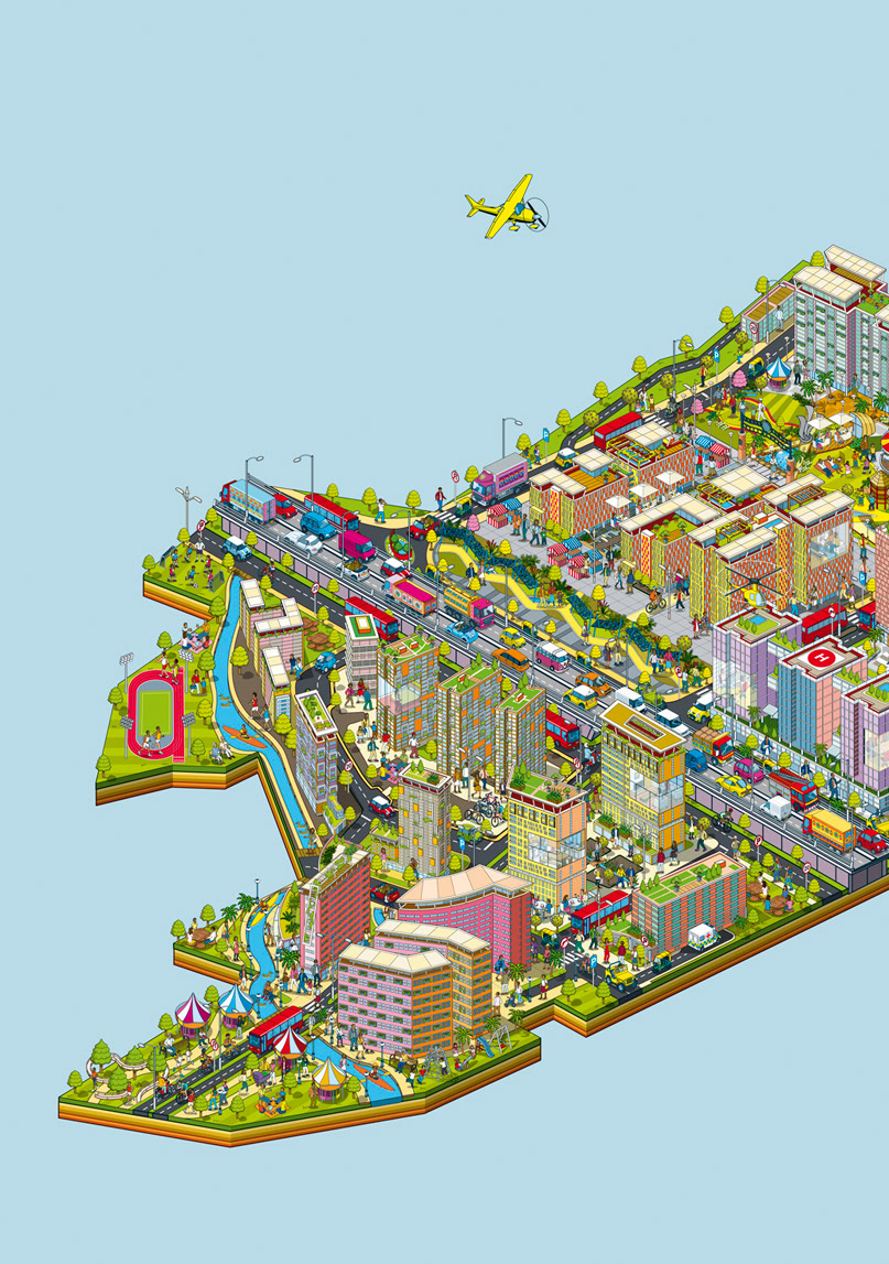
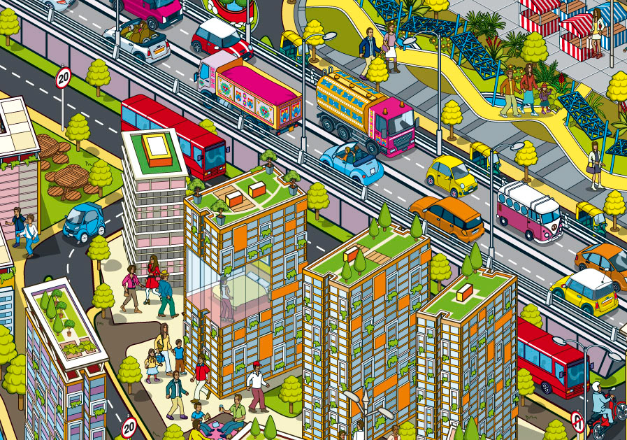
Illustrated 3D Property Development Map revised with updated neighbourhood plans
Rod Hunt was commissioned by Wieden + Kennedy, New Delhi to create a 3D isometric map for the advertising campaign for the Bhartiya City property development outside Bangalore India. In late 2015 Rod revised the map illustration with the new layout for the southern quarter of the development.
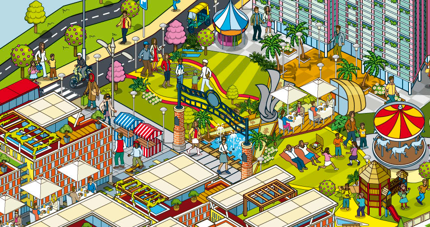
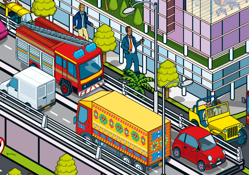
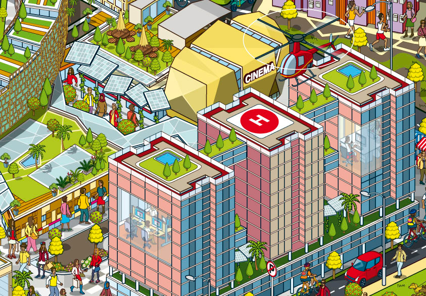
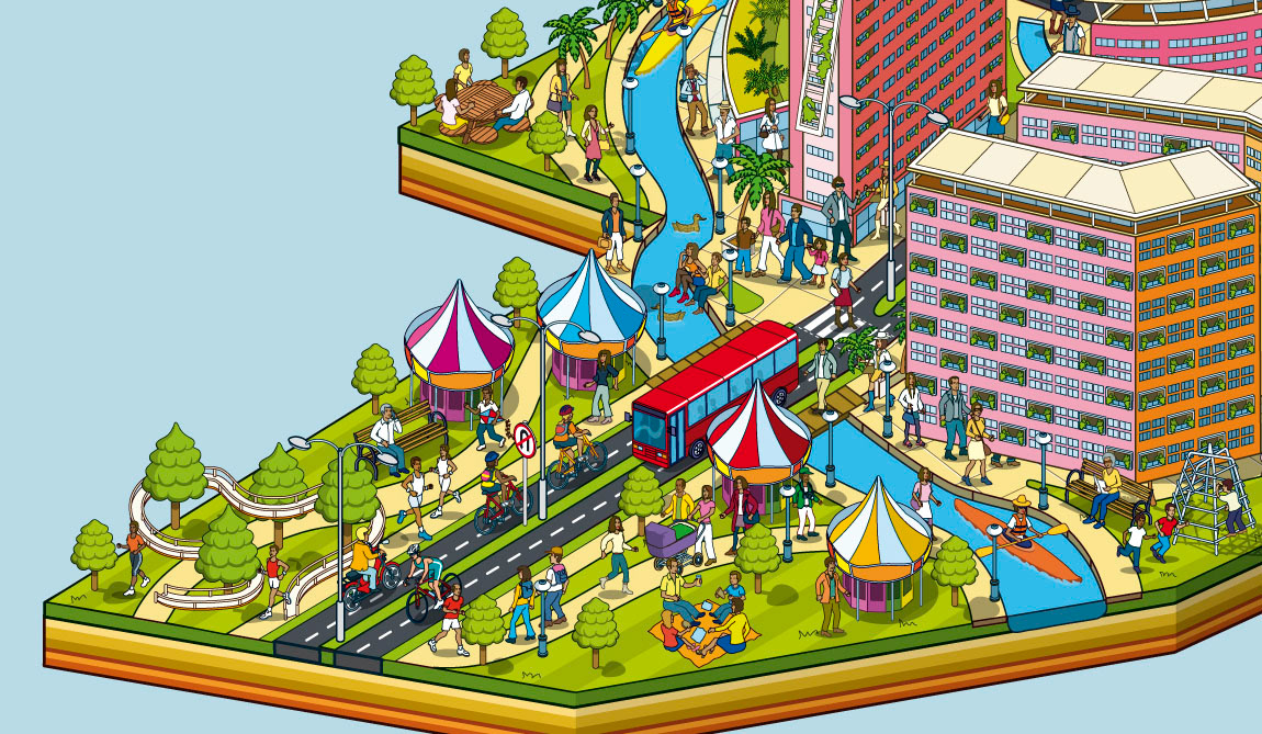
Bhartiya City is the single largest urban development within the limits of any Indian metropolitan area. The 125-acre design, located in North Bangalore, India, will provide a fully-integrated mix of residential, retail, hospitality and Special Economic Zone uses, as well school, healthcare and sports facilities, making it the first of its kind in India.
The new integrated township is spread over 125-acres of land and it has 8 districts which bring together houses in various formats, work segments consisting a large IT SEZ and Financial District, shopping district and a high street, hotels, hospital, school.
Client: Bhartiya City Developers
Agency: Wieden + Kennedy, New Delhi
Agency: Wieden + Kennedy, New Delhi
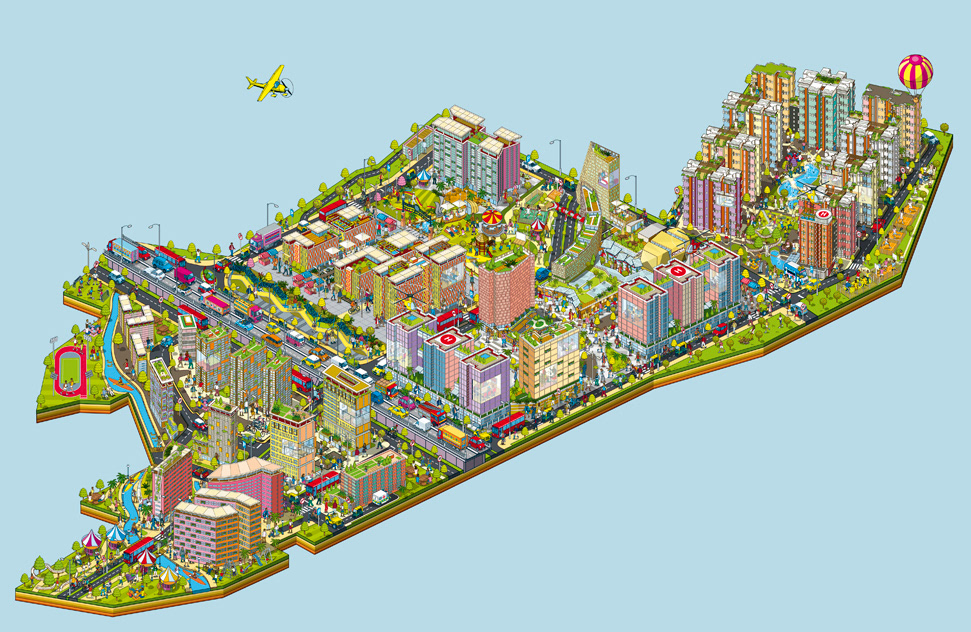
Original Property Development Map Illustration
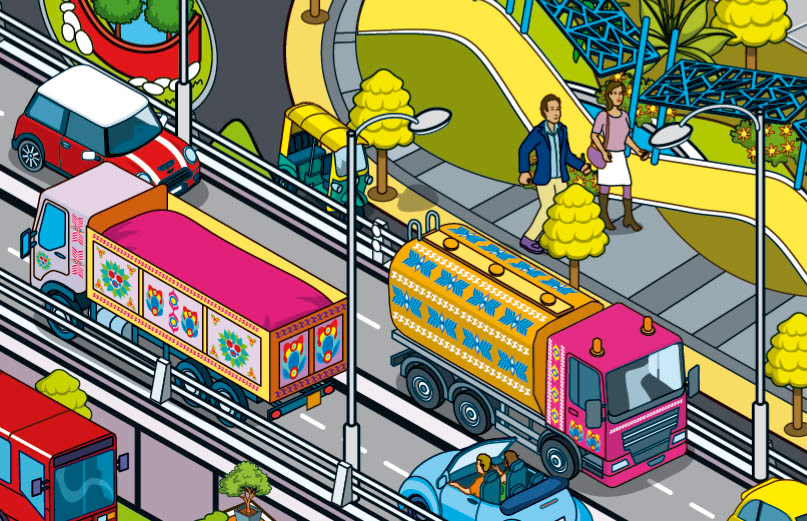
Isometric architectural illustration of the Bhartiya City property development

Isometric architectural map illustration of the Bhartiya City property development in India
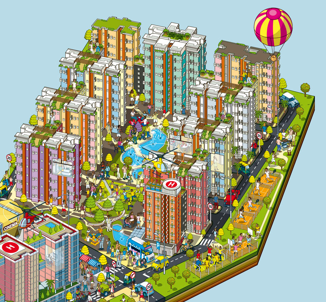
Isometric Urban Cityscape Illustration for a property development


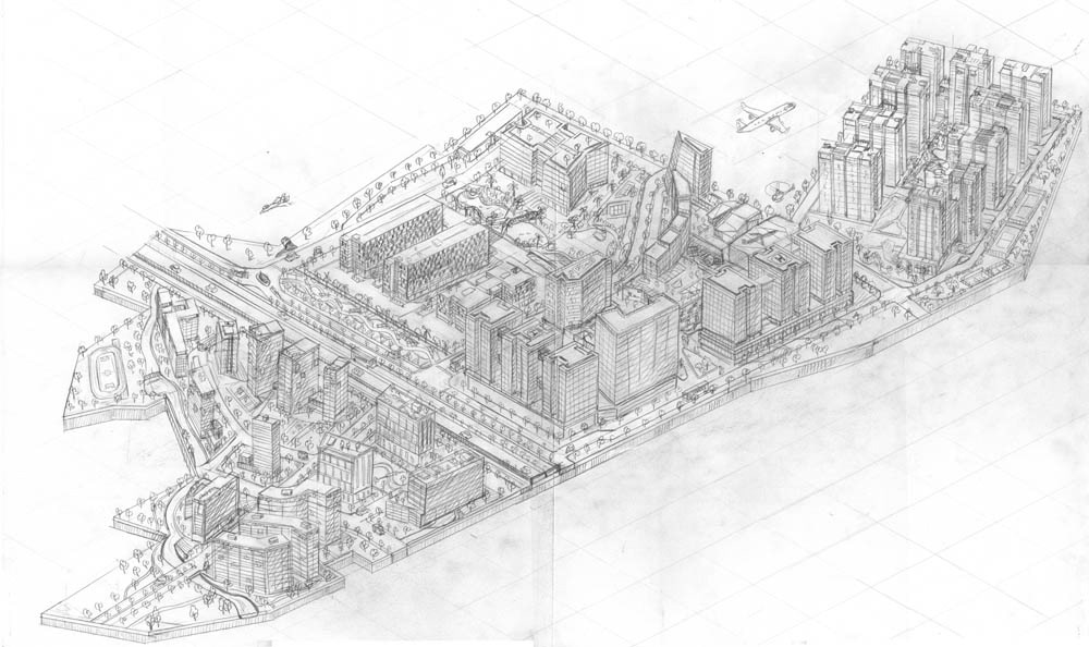
Original Pencil Sketch for the illustrated city map