
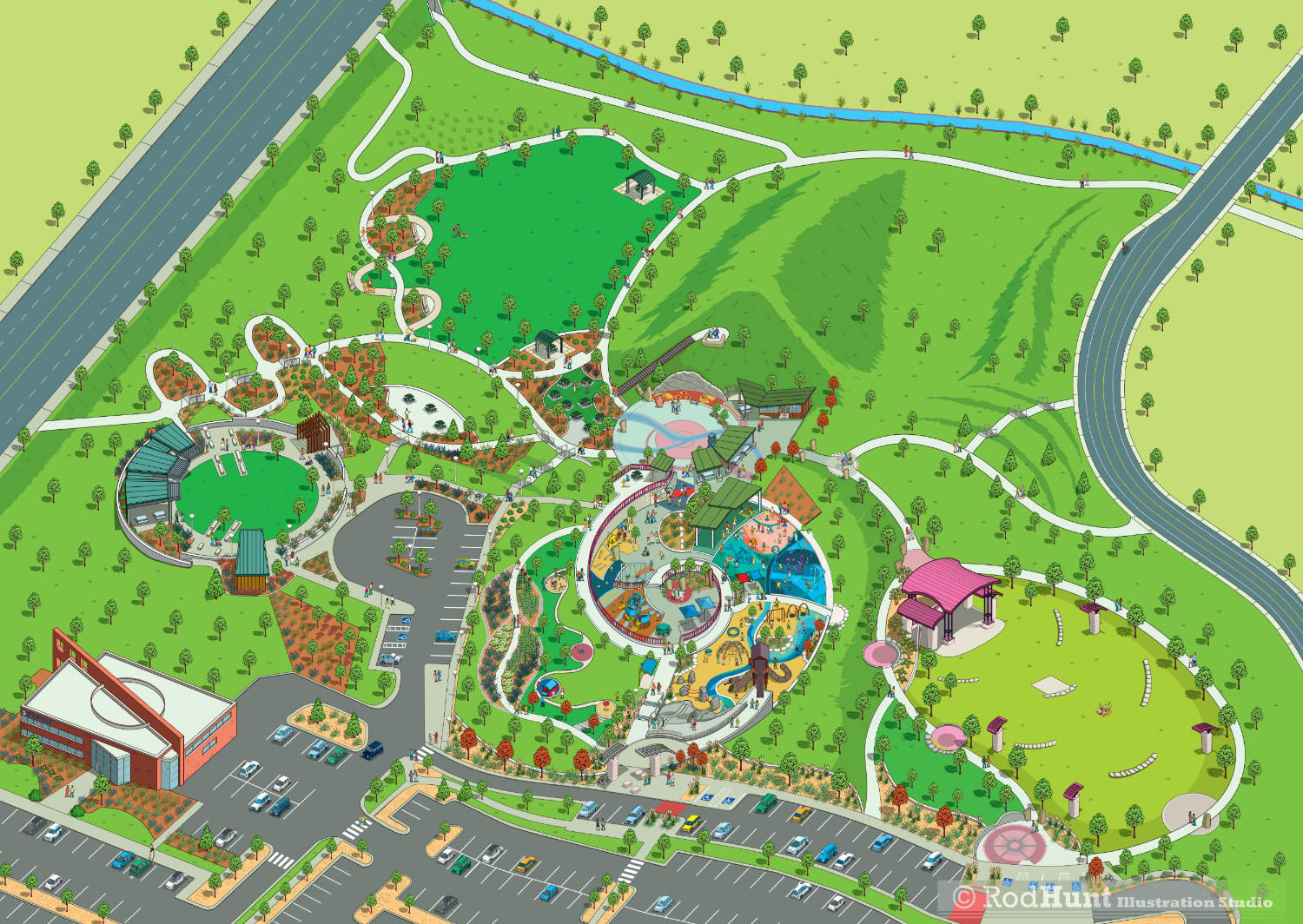
Centennial Center City Park - Illustrated Map of city park, gardens and facilities
The City of Centennial in Colorado commissioned Rod Hunt to illustrate a new and fully updated 3D birds eye view map for Centennial Center Park, incorporating the park's newly expanded and upgraded gardens, landscaping, playgrounds and facilities. In 2012 Centennial opened its first City-owned park, Centennial Center Park. The park has recently undergone a significant expansion, Rod redrew his original illustrated park map to incorporate the new features. This 11-acre, award-winning Park is located adjacent to the Centennial Civic Center continues to be a destination for visitors throughout the state and provides a variety of features and amenities for the community’s use.
In 2023, Centennial Center Park completed a 4-acre expansion. The park features even more amenities and attractions including a picnic grove and shelters, gazebo and gathering space, landscaped walking paths, recreational green space, more restrooms and expanded parking.
The park’s expansion continues to deliver on the City’s Signature Centennial strategic priority, to be a desirable and inclusive community with a lasting built environment, memorable places and experiences that bring people together through intentional planning and community investment.
The visitors guide map has been used for a Centennial Park Interactive Map, in print, onsite way-finding and a large wall mural in the civic building.
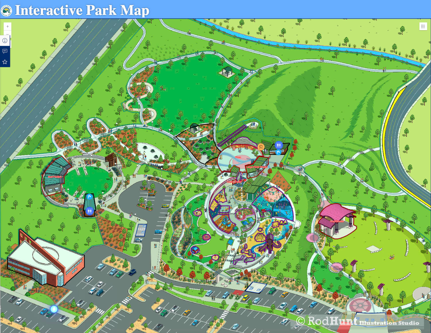
Interactive City Park Map Illustration
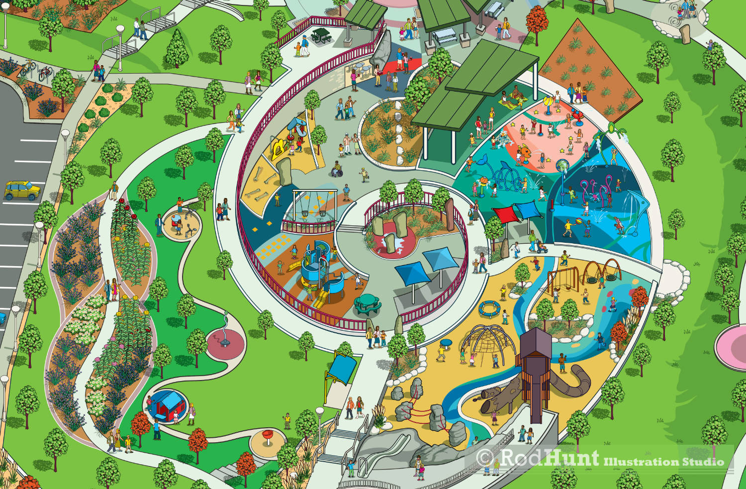
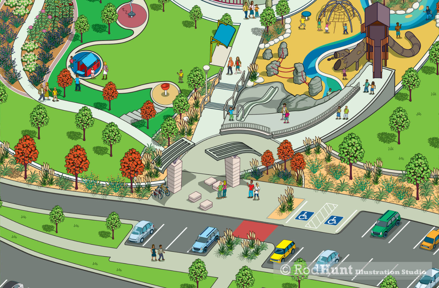
Detailed Illustration of the playground and splash park

Civic Building
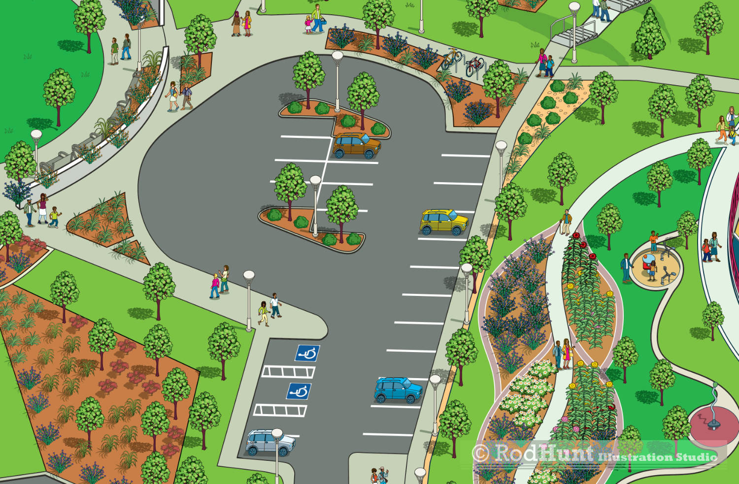
The new map illustration showing the expanded park parking areas
Parking and entrance to the park
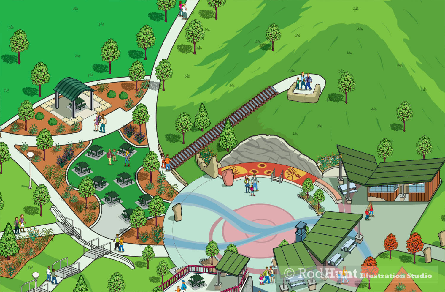
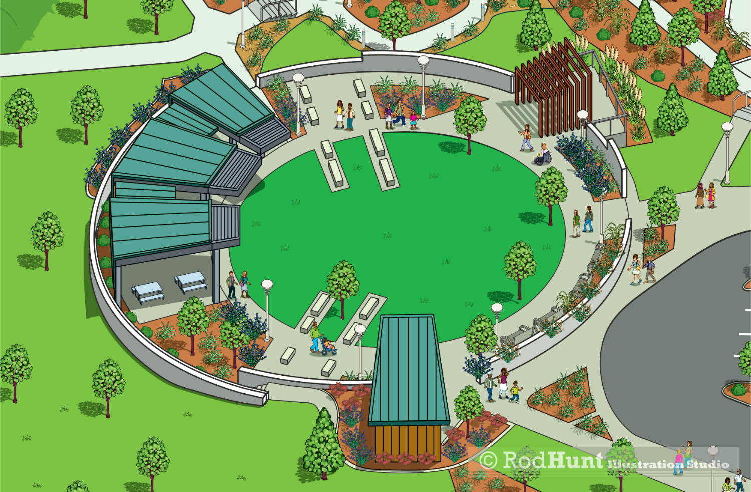
Park gardens and picnic areas
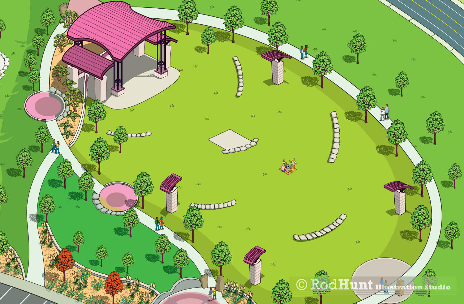
Illustration showing the park's music concert and performance amphitheatre
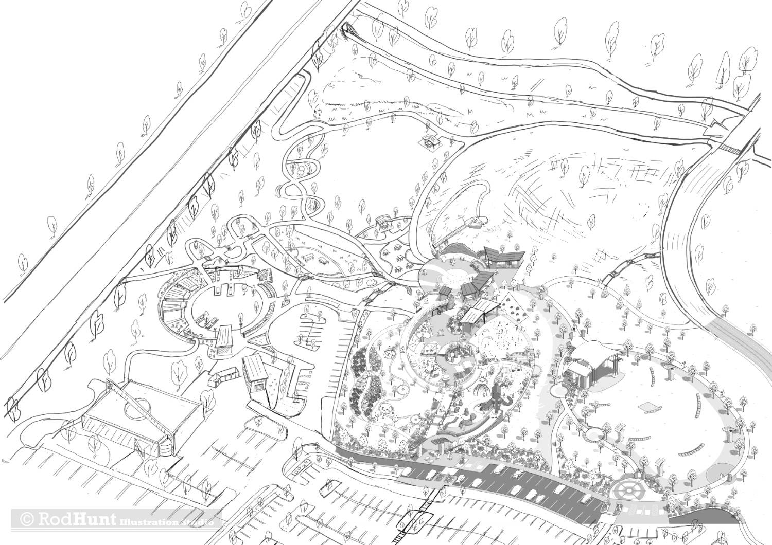
Rough drawing of the revised and expanded illustrated map layout